


11.7.1 Average share of the built-up area of cities that is open space for public use for all
Data refer to 2020.
Interpretation
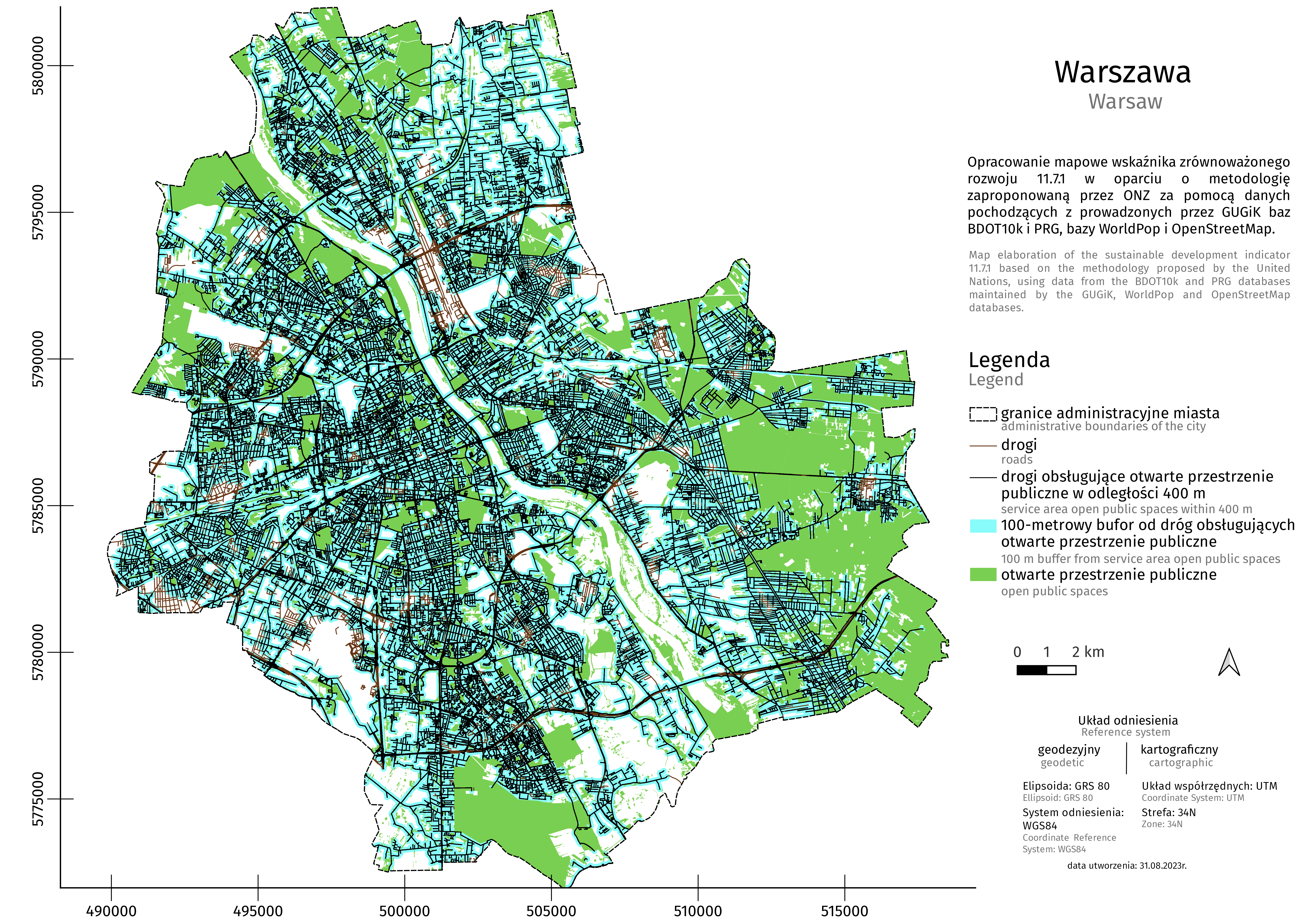
The indicator shows what share of the city's area is open spaces in public use for all, as well as what percentage of residents have access to these spaces within 400 m walking distance.
Public spaces available to everyone include open public spaces for rest and recreation (parks, squares, forests, playgrounds, other recreational areas), as well as land allocated to streets.
Here you can find a set of context indicators, the data for which come from official statistics of Statistics Poland. The purpose of context indicators is to complement the results of experimental SDG statistics, deepen information on the monitored phenomena and provide support in assessing progress in implementing sustainable development.
How did we calculate the indicator?
In order to calculate the indicator, the following stages were carried out:

1. The administrative boundaries of cities were determined from the PRG database (National Register of Boundaries).
2. Open public spaces located within city limits (parks, squares, forests, playgrounds, other recreational areas) were designated using OpenStreetMap.
3. The land allocated to streets was determined from the BDOT10k database.
4. Indicators of the availability of open spaces in public use for all in cities were determined (i.e. open public spaces and land allocated to streets). The value of the indicator 11.7.1 was calculated.
Detailed information on calculations based on the UN methodology can be found in the indicator metadata.
What sources were used to calculate the indicator?
The indicator was calculated based on the methodology proposed by the UN using data from four sources: Topographic Objects Database (BDOT10k) and National Register of Boundaries (PRG) databases maintained by Head Office of Geodesy and Cartography of Poland (GUGiK), and the WorldPop and OpenStreetMap databases.

Topographic Objects Database (BDOT10k) is a vector database containing the spatial location of topographic objects along with their basic descriptive characteristics, corresponding in detail to a traditional topographic map on a scale of 1:10000. The database contains information about the type and category of roads, the type of road surface, as well as the width and length of the road.

National Register of Boundaries (PRG) is an official database providing basis for other spatial information systems. The PRG register collects data concerning area of the whole country, including: boundaries and areas of the units of the three-tier administrative division of Poland (i.e. voivodships, poviats, gminas).


The OpenStreetMap database is an open, global collection of geospatial data, encompassing detailed information about infrastructure and the environment worldwide. This project collects spatial data, including detailed information about infrastructure elements, administrative divisions, and the natural environment. The data is gathered, updated, and verified by a global community of users and volunteers, ensuring its currency and a high level of detail.
Validation
Being prepared...

What is the meaning of the indicator for sustainable development?
Public space, as a place of particular importance in the structure of a city, can facilitate establishing relationships and building social bonds. A well-developed and properly designed network of urban public spaces promotes i.a. walking and social interaction. A system of open public spaces that can be accessed by all residents contributes to the development of social capital and enhances the quality of life in the city.

Applications for local government units
The indicator data provide information that may be useful in making decisions regarding land development, including allocating land for public spaces.